Mercer County Park Conditions

02camaro

Well-Known Member
Couldn't tell you the names of the trails I rode but it was hero dirt today even with the little bit of moisture last night. Weather is iffy for the rest of the day but with no rain you will be able to get a ride in

Screenshot_20200303-141459_Strava.jpg
 

TAS

Well-Known Member
Also rode Tuesday. Super spring conditions! Rode the whole park including Blue north. There are a few trees down on BN but easy enough to get around.. We will get to them in the next week or so. South of the lake from Van Nest to East Picnic is perfect. The red loop east of the east picnic area is still a bit sloppy but everything else is super! SOB, Grail and blue along the lake are fine.
Get out there :thumbsup:
TAS
 
HEAD'S UP!: Multiple car break-ins at Mercer County Park Marina Parking lot adjacent to the volleyball courts this pm, yes, the lot immediately across the street from the ranger station. There were not a lot of cars in the lot at the time. Consideration if you park in the West Parking Lot, the lot across the road from the West Parking Lot; and, the East Parking Lot when there are not a lot of people or vehicles around. Just passing the word along as it was passed along to me. Do not leave your wallet and your valuables, especially toilet paper (just kidding), in your car. Please be aware that the tennis parking lots are closed. Be aware.
 

TAS

Well-Known Member
Rode the entire park on Thursday afternoon. The autumn berry trees are in full bloom and the scent is intoxicating! That said the trail surface conditions are great with a few exceptions. The muddy soft spots over by the big pond on Blue North are getting wider. Blue North, yellow brick road section needs some love but is rideable. We still have a reroute planned but that won't get done until the Covid19 situation has diminished. The red loop east of east picnic area is still very wet please avoid it. There is a tree across blue (along the lake) north, you have to dismount and scramble under it. Al got the tree across the trail in the section adjacent to the power lines across from the west picnic area.
There a lot more folks out on the trails so please be mindful and give plenty of space. Covid19 or not.... spring has arrived and the woods is beautiful. Rejuvenate your mind and soul....take a leisurely ride..... I did.
TAS
 

Attachments

  • IMG_0027.jpg
    IMG_0027.jpg
    154.4 KB · Views: 123
  • IMG_0030.jpg
    IMG_0030.jpg
    208.5 KB · Views: 133
Last edited:

ByteOfCake

New Member
I biked the part of the blue trail that goes along Conover for the first time yesterday. I've lived close by for 10 years and I never knew there was a trail here lol. Ran into the access road for the powerline and after walking through the forest for 20 mins I couldn't find the unmarked trail (After digging around online, I discovered that it doesn't exist anymore ;-; ). Are there any plans to reconnect the access road to the other part of the blue trail? (across bridegroom run). I don't like using the main road to get to the east picnic area. Also, I've heard about a trail that is by north post road that goes by the farm field. Where exactly does it start? Is it still bikeable?
 
Last edited:

Rusty

Well-Known Member
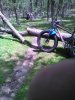
Ok, short answer is no. Long ago there was a beaver dam crossing back there but its not gonna happen again.
Up by North Post, there is only the Trolley Line trail, which is a paved path thru west windsor, which is currently all fubar due to the powerline work. I think that is what you may be referring to. If you meant the trails to the left heading north out of the rowing center, then they are also lost forever, mostly due to the golf course expansion. No circumnavigation of the lake anymore.

If you know of some other trail, lets find that thing....
 

TAS

Well-Known Member
Yessir.. A bit of history here...Years ago there was a marked blue trail on the map (published in 2003) off the south side of the power lines that connected to the Red Trail east of the East picnic area...I and many others rode it. During summer months it was dry... Materials had been acquired and there were plans (park approved) for a bridge to be constructed to cross the creek. Fast forward a few years and: Water table changed dramatically due to new houses and extra runoff. In addition there appears to have been a beaver dam that blocked the creek.The creek water level no longer dropped and the swamp stayed swampy year round. The project was abandoned and the materials used elsewhere.

The blue line is the official route. continue down the power line and turn right onto the road.
It crosses over the creek with an aluminum bridge. Left onto Darvel Dr, right on Edinburgh to the park entrance at East Picnic.

MCP  Blue to red at Powerlines1.png


I also remember riding the around the entire lake and I am ancient!
TAS
 
Last edited:

Wildwalker

Active Member
Did the Blue loop this morning. Started at the East parking lot. Few soft spots, no standing water. Only saw two others on bikes bout 4 people walking. Weather was perfect. Last time out I didnt remember seeing the black bike on the bike tree, guess I was in the zone lol.
20200522_074705.jpg
 

Trail Conditions

Current Conditions

powered by Trailforks.com
Top Bottom