


You are using an out of date browser. It may not display this or other websites correctly.
You should upgrade or use an alternative browser.
You should upgrade or use an alternative browser.
"Official" BIYF 2016-2017 thread
- Thread starter Red Mosquito
- Start date
Limping along.....
Wednesday, Jan 18, 2018
BIYF minimum
Moving time 01:03:50
15.5 miles
Roubaix
Traction line from Madison to Morristown, then to South Street to catch Loantaka Brook path back to Madison. Lots of eyes in the woods......
Wednesday, Jan 18, 2018
BIYF minimum
Moving time 01:03:50
15.5 miles
Roubaix
Traction line from Madison to Morristown, then to South Street to catch Loantaka Brook path back to Madison. Lots of eyes in the woods......
w_b
Well-Known Member
1/18 Top of the Green 2:08 https://www.strava.com/activities/836789892
Christine suggested a way without too much DBC potential that also sidesteps my favorite freight train blocking Whitman on the way to Metuchen. Checked it out tonight and purty good. Nice night to be out.

BONUS street art. i think the colors on this work well together. It's tough to get it to look good with my lighting.
I like the other one on my Strava better but NSFW and definitely NSFN. Extra level of security, if you are still interested, and your name isn't Norm, go click.

Go Ride!
Christine suggested a way without too much DBC potential that also sidesteps my favorite freight train blocking Whitman on the way to Metuchen. Checked it out tonight and purty good. Nice night to be out.
BONUS street art. i think the colors on this work well together. It's tough to get it to look good with my lighting.
I like the other one on my Strava better but NSFW and definitely NSFN. Extra level of security, if you are still interested, and your name isn't Norm, go click.
Go Ride!
Last edited:
Frank
Wookie
Trails may be too wet so I decided to hit the beach......what a morning!!
https://www.strava.com/activities/837072186


https://www.strava.com/activities/837072186
- 6.4mi
Distance
- 1:04:44
Moving Time
But Mike is legit and hits elevation correction, unlike some guy that just retiredIf I was street cred Kev I mean @stb222 I'd say "what climbing?". Great ride btw!
a nice ride to the beach yesterday. Did the big climb - if it weren't for the 200 people on the sidewalk, i may have been faster.
1/18/2017
2:30:03
https://www.strava.com/activities/836526883
is public art considered street art? Not much tagging going on down here.

1/18/2017
2:30:03
https://www.strava.com/activities/836526883
is public art considered street art? Not much tagging going on down here.
choop
Well-Known Member
1/19
Lunch ride. Wish I could have spent another 5 hours out there
1:08 MT
https://www.strava.com/activities/837294761
Lunch ride. Wish I could have spent another 5 hours out there
1:08 MT
https://www.strava.com/activities/837294761
rick81721
Lothar
1/19
@Mountain Bike Mike inspired me to do some climbing today. Decent day to hit the sourlands hills. Always like the view from top of Montgomery rd:

3:26
https://www.strava.com/activities/837504380
And update on Lumos helmet - apparently it works great after all. It was in beta mode which makes it unstable. Got it out plus updated the firmware and it has worked perfectly for 3 straight rides. Today it was on for over 3.5 hrs and when I got home there was still 53% of battery life left. @stb222 gloated too soon! And sorry guys for submitting an international (they are based in Hong Kong, BBB doesn't cover) consumer fraud complaint - but they still haven't returned any emails yet so that's what they get for no customer support.
@Mountain Bike Mike inspired me to do some climbing today. Decent day to hit the sourlands hills. Always like the view from top of Montgomery rd:
3:26
https://www.strava.com/activities/837504380
And update on Lumos helmet - apparently it works great after all. It was in beta mode which makes it unstable. Got it out plus updated the firmware and it has worked perfectly for 3 straight rides. Today it was on for over 3.5 hrs and when I got home there was still 53% of battery life left. @stb222 gloated too soon! And sorry guys for submitting an international (they are based in Hong Kong, BBB doesn't cover) consumer fraud complaint - but they still haven't returned any emails yet so that's what they get for no customer support.
rick81721
Lothar
But Mike is legit and hits elevation correction, unlike some guy that just retired
What does elevation correction have to do with the hills he climbed? I wasn't even looking at his total elevation. And I'm sure you use elevation correction on every ride 🙄
The last two years, you use the number of feet gained as a goal. Elevation correct means nothing in relation to the hills you rode, but if you are using elevation as a metric of your success, by not using elevation correct, you are just cheating yourself. For instance, today's ride was 1,500 before, 1,000 after. I don't use elevation gain as a metric, I am more interested in no making it seem like I climbed more.What does elevation correction have to do with the hills he climbed? I wasn't even looking at his total elevation. And I'm sure you use elevation correction on every ride 🙄
Not sure if I am missing something but the view in this picture looks the same as all of your other pictures 😉. Also, wouldn't need to unzip if you were wearing a under 32 jacket.1/19
@Mountain Bike Mike inspired me to do some climbing today. Decent day to hit the sourlands hills. Always like the view from top of Montgomery rd:
3:26
https://www.strava.com/activities/837504380
And update on Lumos helmet - apparently it works great after all. It was in beta mode which makes it unstable. Got it out plus updated the firmware and it has worked perfectly for 3 straight rides. Today it was on for over 3.5 hrs and when I got home there was still 53% of battery life left. @stb222 gloated too soon! And sorry guys for submitting an international (they are based in Hong Kong, BBB doesn't cover) consumer fraud complaint - but they still haven't returned any emails yet so that's what they get for no customer support.
thegock
Well-Known Member
1/19
1:51
https://www.strava.com/activities/837464485
What's up with those FAKE MOMS? And who still wears pants, anyway?
FTW-Bonus!!!
.jpg")
1:51
https://www.strava.com/activities/837464485
What's up with those FAKE MOMS? And who still wears pants, anyway?
FTW-Bonus!!!
Mountain Bike Mike
Well-Known Member
1/19 - Triple
Commute in: 2:00:48 - Nice and slow ride in today. Took time to take in the sights. I was having fun shining my helmet light into the fields and trees to see glowing eyes. I caught three pair of eyes at the top of a tree so I stopped to check it out. Turned out to be a family of raccoons. They were spooked and tried to hide behind the tree trunk and they kept peeking to see me. Also picked up on a bunch of smells this morning. I really appreciated the smell of fireplaces and fermenting apple as I passed the apple orchard. Snapped a pic of a nice Mopar - see car spotting thread. To top it off, I nabbed a sunrise shot as I pulled into the office park.

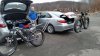
Lunch ride: 1:13:39 Broride with @stb222 - He was late but I could tell he was sorry cause he was out of breath and averaged 19.8mph uphill in a headwind to meet me. Good dude! We put in a little dig on the poor farm climb for fun and then rolled around shoot'n the shit until we split ways. Bonus - stopped and snagged a pic of a parking lot full of nice cars - see Car spotting thread. Good times.
Commute home: 1:12:08 Just a nice easy cruise home, downhill with a tail wind most of the way.
Great day on the bike!
Commute in: 2:00:48 - Nice and slow ride in today. Took time to take in the sights. I was having fun shining my helmet light into the fields and trees to see glowing eyes. I caught three pair of eyes at the top of a tree so I stopped to check it out. Turned out to be a family of raccoons. They were spooked and tried to hide behind the tree trunk and they kept peeking to see me. Also picked up on a bunch of smells this morning. I really appreciated the smell of fireplaces and fermenting apple as I passed the apple orchard. Snapped a pic of a nice Mopar - see car spotting thread. To top it off, I nabbed a sunrise shot as I pulled into the office park.
Lunch ride: 1:13:39 Broride with @stb222 - He was late but I could tell he was sorry cause he was out of breath and averaged 19.8mph uphill in a headwind to meet me. Good dude! We put in a little dig on the poor farm climb for fun and then rolled around shoot'n the shit until we split ways. Bonus - stopped and snagged a pic of a parking lot full of nice cars - see Car spotting thread. Good times.
Commute home: 1:12:08 Just a nice easy cruise home, downhill with a tail wind most of the way.
Great day on the bike!
Last edited:
1/19/2017
1:55:49
https://www.strava.com/activities/837611385
quick out and back. Winds were up today. quads are feeling it tonight.
these short palms(?) look like the might be covering a variety of things that will "getcha"

1:55:49
https://www.strava.com/activities/837611385
quick out and back. Winds were up today. quads are feeling it tonight.
these short palms(?) look like the might be covering a variety of things that will "getcha"
rick81721
Lothar
The last two years, you use the number of feet gained as a goal.
Where'd you read that nonsense? I never set any elevation gain goals - just cite total at the end of the year as a metric of comparison.
...by not using elevation correct, you are just cheating yourself. For instance, today's ride was 1,500 before, 1,000 after. I don't use elevation gain as a metric, I am more interested in no making it seem like I climbed more.
So riddle me this batman, if your garmin device records no elevation gain during more gradual but obvious climbs (like mine did today and most rides), how is strava's elevation "correction" more accurate? Does not compute. I believe it makes sense on those rare days when the atmospheric pressure is high and you can see the elevation gain is being inflated, but IMO the usual rides where you get gypped compensates for those more rare occasions. I'd have to see a scientific analysis that strava's elevation correction is more accurate for our specific area and rides we do.
Also, wouldn't need to unzip if you were wearing a under 32 jacket.
I'd rather over-dress and be able to compensate (like today) than under-dress and freeze (like my previous ride). Something I won't have to worry about when I finally move out of stinkin NJ!
Mountain Bike Mike
Well-Known Member

knobbyhead
Next off the Island.
1 hour 30 mins, 539 ft of elevation. Which is exactly the same amount of elevation change as my last ride on a different route. Wierd.
https://www.strava.com/activities/837271453
No pictures. Beautiful out!
Trying to stay out of last place.
https://www.strava.com/activities/837271453
No pictures. Beautiful out!
Trying to stay out of last place.
Where'd you read that nonsense? I never set any elevation gain goals - just cite total at the end of the year as a metric of comparison.
So riddle me this batman, if your garmin device records no elevation gain during more gradual but obvious climbs (like mine did today and most rides), how is strava's elevation "correction" more accurate? Does not compute. I believe it makes sense on those rare days when the atmospheric pressure is high and you can see the elevation gain is being inflated, but IMO the usual rides where you get gypped compensates for those more rare occasions. I'd have to see a scientific analysis that strava's elevation correction is more accurate for our specific area and rides we do.
I'd rather over-dress and be able to compensate (like today) than under-dress and freeze (like my previous ride). Something I won't have to worry about when I finally move out of stinkin NJ!
on a road ride, garmin is able to use the usgs elevation street data - it eliminates weather changes that can affect the barometric altimeter. especially if a front is going through. GPS elevation data should be better with waas, but is still sketchy.
tonyride
Don't piss off the red guy
http://www.mapmyride.com/workout/19..._type_map=["fitness.bikes"]&action_ref_map=[]
Did a night ride tonight. 2:06 and 9.01 miles.
Did a night ride tonight. 2:06 and 9.01 miles.
Zaskar
Well-Known Member
1/19 - Moving time - 1:42
Everybody's smoking and no one's getting high
Everybody's flying and never touch the sky
There's Ufo's over New York and I ain't too surprised
UFO's

Art

https://www.strava.com/activities/837683230
Everybody's smoking and no one's getting high
Everybody's flying and never touch the sky
There's Ufo's over New York and I ain't too surprised
UFO's
Art
https://www.strava.com/activities/837683230