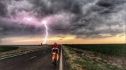
The Longest Day 2021

**following**

since June 19/20 is Father's Day weekend this year might be able to use that for extra justification on the homefront to do something this ridiculous. Its been on my bucket list for a while.

will see how my 125 miler goes in April.

very slim/narrow chance I might be able to see if one of my teenagers would drive my car for SAG support. depends on how many people join this ride. Middle son did this for me and brought a friend when we planned our mini Gran Fondo event back in September and we all chipped in a few bucks for gas and "tips". we had coolers in the car with drinks and food and everyone's supply bags.

+1 to play the Father’s Day card

Also +1 to likely have the fam help with SAG, at least at some predetermined stops for food/h2o/etc.

re Kansas, I stand humbly corrected. I must have taken the flat route.
 

Attachments

  • 0B5E89DA-7560-4694-99BD-E586022AEC02.jpeg
    0B5E89DA-7560-4694-99BD-E586022AEC02.jpeg
    28.6 KB · Views: 110
  • BB471D4D-6C43-498C-9D05-CE8A4684A4A4.jpeg
    BB471D4D-6C43-498C-9D05-CE8A4684A4A4.jpeg
    54.8 KB · Views: 110
Is it too late for me to get in on this action? I did the Longest Day in 2019, but had to bail out at mile 165, because I didn't get there until 10:30 PM. I have a score to settled. I don't think I'll be physically ready to do it by mid-May. By June 21st? Definitely. I don't think the aid stations were a big deal I provided all my own support/meals, and to be honest, by the time I go to the aid stations, they were already closed anyway. I hope to improve on that this year.

I think we should keep it as close to June 21st as possible to stick with the tradition of doing it on the longest day of the year.
 
+1 to play the Father’s Day card

Also +1 to likely have the fam help with SAG, at least at some predetermined stops for food/h2o/etc.

re Kansas, I stand humbly corrected. I must have taken the flat route.
Driving through Kansas on the interstate is deceiving. It appears flat, but as you drive across it (from the east) by the time you reach the border with Colorado, you're already 5000 feet above sea level. When they build highways, they do a lot to keep them as "flat" as possible. They literally levelled small mountains when they extended Route 287 upto and past Rt 23 in North Jersey. Watch the GCN video on doing the Dirty Kanza - it shows some the long hills on the course.
 
I know a group that’s planning to do this. some of the folks you met on the Cranbury pre ride from Morristown area have something set in motion.

Can make a connection if you want.
 
I'll assume everyone forgot about this?
1. Definitely not.

Yes. I have a 600k the weekend after so I'm looking for a fairly easy day.
2. Freaking badass.

I know a group...
3. I've recently reconnected with the M3C crew and would appreciate this connection as well. Don't have the miles of Mr. Vreeland here but think I can manage it, especially with a small group working together. Also, some experience re logistics, route, best pit stops etc would be helpful. Up here I'm pretty versed but fear the pine barrens if not planned properly!
 
I can ride the course blind at this point so let me know what distance you want between stops. I normally would only stop once in Browns Mills but there are actually plenty of places along the way. Longest stretch is probably from Brown Mills to Egg Harbor which is like 45-50 miles? And there is a hot dog stand in Chatsworth that has stuff so if things really go South there are options.
 
Hmmm I may be slightly out of my league here as I was thinking something like every 35 miles or so, primarily for fluids, but also something resembling real food.
I'm thinking 3 bottles (good for ~2 hrs for me) & a few hours worth of snacks on board but if this is misguided, tips welcome.
If you have a recommended course, a GPX and any specific stops would be helpful (I've seen many variants online).

Lastly, to sanity check I'm not getting dropped in the first 50 miles, what sort of moving speed would you be targeting over that distance?
 
35 miles might be a bit on the scarcer side, but doable. The top will be a bit scarce in the early am. There's a QuickChek right on 206 before the Rt80 bypass in Waterloo. I don't remember much else in that section but it's early in the ride and I don't think I've ever stopped through there.

I'd plan on riding between 19-20mph moving, which is super easy in a group.
 
Hmmm I may be slightly out of my league here as I was thinking something like every 35 miles or so, primarily for fluids, but also something resembling real food.
I'm thinking 3 bottles (good for ~2 hrs for me) & a few hours worth of snacks on board but if this is misguided, tips welcome.
I've got one word for you: CamelBak! Actually, I prefer the Osprey Raptor to anything Camelbak makes, but you get the idea. 3L of fluids, plus plenty of room for food, spare tubes, tools, and a headlight! Yes, I'm originally a MTBer. I've lost more than my share of water bottles on the trail, and have had to hike miles out of the woods with flats, etc.

You'll definitely pass plenty supermarkets and convenience stores and fast food places. Even at the start, which takes you through some of the most remote parts of NJ, there's a couple of bagel shops and diners on the route, if I remember correctly. There's some stretches in the Pine Barrens that are pretty desolate, but if you stop to load up at Hot Diggity Dogs in Chatsworth (it's a hot dog stand in someone's front yard, but actually pretty popular spot!), you'll be good until you make it back to civilization.
If you have a recommended course, a GPX and any specific stops would be helpful (I've seen many variants online)
The "official" course from CJBC on ridewithgps.com. This is the course from 2019, which was the last(only) time I did it:


I think the course has been the same for years. Jim can confirm.
Lastly, to sanity check I'm not getting dropped in the first 50 miles, what sort of moving speed would you be targeting over that distance?

CJBC used to plan on an average speed of 15 MPH as a guide for when they would open/close their rest stops.
 
I'll assume everyone forgot about this?
I didn't booking a hotel right now for me and my support vehicle driver. Looking at the rates, it looks more like I'll be staying at the Rosebud Motel, or the Bates Motel.

I've been hitting the trainer and the road since January, but haven't put in too many long days, though. Not sure I'll make it this year, either, but I'm going to try!
 
Course is always the same base. Sometimes there are re-routes from construction or something. Kevin would drive the route and make sure it was good, but we're on our own now. Worst time was when the bridge in Egg Harbor was out and the Detour was like 20ish miles. I might have that file.
 
Back
Top Bottom