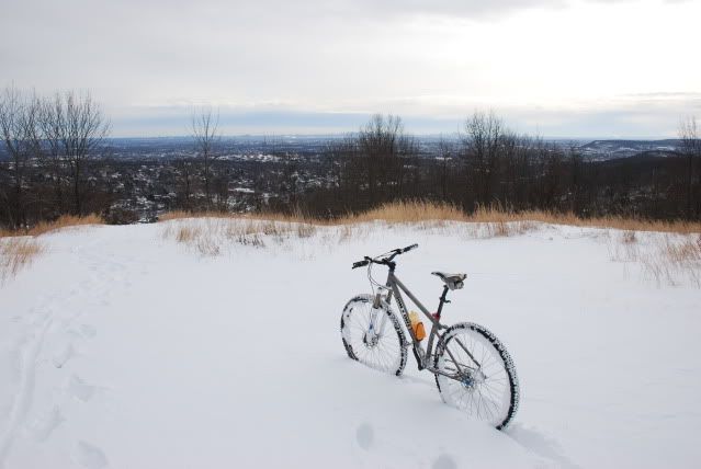
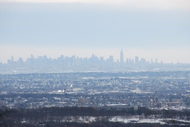
high mountain blues?

liong71er

Well-Known Member
quickly down and up!!

rode here right after i finished my work.trails mostly rideable and still have patch of snow at some section,wetland here. so prepared to get "wet feet"...,water running fast in middle of the trails (downhill) at white trails towards golf course.also flooding at the stream that intersect with the trails esp.on white trails.
then i gave my love back to this place, by clearing couples fallen (small)tree in middle of the trails.some are big tho ranging from 10-25cm diameter.but luckily it's a rooten tree so it's easy to remove them.

http://connect.garmin.com/activity/20346320
 
Last edited:

freeride

New Member
your training route

Good on ya to get dialed in to a "training route". I bike Rea ave, via goffle (taked you to Hi Mt).

I'm curious if I can bail this place at the west end on Indian Rd (at breakneck rd) en route to canonball (via Schuyler/Barbara Dr):popcorn:
 

liong71er

Well-Known Member
Good on ya to get dialed in to a "training route". I bike Rea ave, via goffle (taked you to Hi Mt).

I'm curious if I can bail this place at the west end on Indian Rd (at breakneck rd) en route to canonball (via Schuyler/Barbara Dr):popcorn:

i think you can!you probably have to cross private property or swamp!:)

the last time i try (w/o gps) i ended up on valley rd.bypassing yellow trails.

and then i try another one on different day, after coming out from yellow trails i took indian trail dr (it's an estate housing area) then heading out to franklin lake rd then CR 502 towards oakland (terhune) then turn right on hamburgh tpk-into pomton lakes -colfax-schuyler-barbara dr-cannonball-then i go all the way up to ringwood then out on ringwood ave towards jungle habitat-then wawayanda then valley rd (west milford) to otter hole rd towards macopin rd then warwick tpk back to where i started(these back when i don't own a GPS 2 yrs ago).done these couples of time alone wit various route mostly on road and one time with a friend.

normally if i wanna go to cannonball.i just take hamburgh TPk into pomton lakes then schuyler-barbara dr-cannonball-ringwood and back via skyline drive going down again at schuyler-then go home.

i'm thinking going to ringwood on sunday with my usuall route but w/o make a stop at HM.hopefully the weather will cooporate.
 
Last edited:

soundz

The Hat
Team MTBNJ Halter's

freeride

New Member
This ride below I came down Skyline. I got lost on top of hill in f.l. trying to enter hi mtn.

Hi Mtn entrances I found in F.L.
  1. Indian Trail
  2. Dakot Trail
  3. Sciotto
There must be a way out w/o crossing private property on Breakneck/Indian Rd

dfg.jpg
 

JTK37

Member
Freeride, have you checked out any of the "vacant" land that borders the HM side of Berdan ave just past the top of Breakneck? Opposite Indian Trail(Wayne) or the Toy's R' Us light?
 

freeride

New Member
Freeride, have you checked out any of the "vacant" land that borders the HM side of Berdan ave just past the top of Breakneck? Opposite Indian Trail(Wayne) or the Toy's R' Us light?
I really wanted to go today but I dropped the ball:mad:
 
Last edited:

freeride

New Member
hi mtn lunch ride 12-14-09

Here's a way from hi mtn towards canon ball
123.JPG


used an official exit/entrance to hi mt as listed by town of wayne

111.jpg


coincidently i nearly reached my max hr on the ride today

Max HR
189
Time
1:00:24
 

freeride

New Member
Back Door to Hi Mt: Cynamid

Checked out the Blue on a trail run today.
asas.JPG


This will get you near Indian Dr en route to Canon Ball

I'll be MTBing it on Sunday morning out of Market Basket, post back or pm if you're interested:popcorn:
 

JTK37

Member
Checked out the Blue on a trail run today.
asas.JPG


This will get you near Indian Dr en route to Canon Ball

I'll be MTBing it on Sunday morning out of Market Basket, post back or pm if you're interested:popcorn:

Yes!!!!!! Thats exactly where I meant. Cross the Street and you can head Down Indian(Trail or Rd) to 202 .
 

freeride

New Member
Yes!!!!!! Thats exactly where I meant. Cross the Street and you can head Down Indian(Trail or Rd) to 202 .

Idian Rd is where you can exit Hi Mt in Wayne and it goes to 202. Indian Trail is in Franklin Lakes and it also connects to Hi Mt

wwwd.jpg


After two months of going to Hi Mt at least once per week, I have a basic knowledgeof the Red, White, Yellow, and Blue. There's unmarked trails, and this orange trail there's two markers near F.L. then two in Wayne

IMG_0683.JPG


I'm getting a Delorme PN-40 in a couple of days, perfect time for the winter and exploring new places:popcorn:
 

liong71er

Well-Known Member
snow ride or should i say "hike a bike and ride some"

yes i litterally walk my bike all the way to the top of HM and i get a nice downhill run after that...but it's whort it i feel leg burning for good. other than running into a hiker,and a husky also a xc skier,..so far so good!i think the snow was about 1' deep...maybe more not so sure.

http://connect.garmin.com/activity/20788501

DSC_0183.jpg


DSC_0178.jpg
 
Last edited:

freeride

New Member
good deal, i was gonna bike hi mtn today but went to s f instead (sterling forest), i was thinking of heading over to the blue w/mtb or x-c ski, it looks like you took the yellow
 

liong71er

Well-Known Member

Attachments

  • DSCN1390.JPG
    DSCN1390.JPG
    191.1 KB · Views: 311
  • DSCN1392.JPG
    DSCN1392.JPG
    177.7 KB · Views: 293
  • DSCN1395.JPG
    DSCN1395.JPG
    159.2 KB · Views: 292
  • DSCN1400.JPG
    DSCN1400.JPG
    153.5 KB · Views: 311
  • DSCN1397.JPG
    DSCN1397.JPG
    172 KB · Views: 313
Last edited:

JTK37

Member
Has anyone been out recently? Might have the afternoon to myself tomorrow and thinking about getting out for a bit.

Any experiences with the Wayne PD and street parking on Chicoppee?
 

liong71er

Well-Known Member
i'm not so sure with wayne PD if you park at chicoppee,coz i never drive to trail head. you can park in entry #5 parking lot it's alot safer.
 

lou_b_83

New Member
Has anyone been out recently? Might have the afternoon to myself tomorrow and thinking about getting out for a bit.

Any experiences with the Wayne PD and street parking on Chicoppee?

There are cars parked on the side all the time. I don't see why they would care. If you are nervous just park at the Residence Inn hotel and ride to the trail head. That is what I do but at work at the hotel:D. Have fun.
 

liong71er

Well-Known Member
"around the woods and the town"

my rides ended up around high mountain and downtown paterson.it bcoz,i blew my shradder valve off cause by stick/branches.since i only carry one spare tube.normally i always carry 2 tube if i'm going or long distance riding.

yesterday's higlight:
rode red trail--->white--->yellow--->blue--->downtown paterson.

http://connect.garmin.com/activity/29038620

red marked trail,y or u or uc shape tree,moss carpet,cliff,and an old abandoned water tank on hill of high mountain near by golf course,..
 

Attachments

  • DSCN1718.JPG
    DSCN1718.JPG
    186.6 KB · Views: 282
  • DSCN1720.JPG
    DSCN1720.JPG
    168.5 KB · Views: 280
  • DSCN1713.JPG
    DSCN1713.JPG
    179.4 KB · Views: 282
  • DSCN1716.JPG
    DSCN1716.JPG
    184.1 KB · Views: 267
  • DSCN1730.JPG
    DSCN1730.JPG
    187.7 KB · Views: 268
Last edited:

liong71er

Well-Known Member
another one...

rock,tires,geese,and the greatfalls,..
 

Attachments

  • DSCN1741.JPG
    DSCN1741.JPG
    225.3 KB · Views: 265
  • DSCN1711.JPG
    DSCN1711.JPG
    177.3 KB · Views: 261
  • DSCN1755.JPG
    DSCN1755.JPG
    183.4 KB · Views: 264
  • DSCN1764.JPG
    DSCN1764.JPG
    183.4 KB · Views: 266
  • DSCN1763.JPG
    DSCN1763.JPG
    180 KB · Views: 266
Last edited:

Trail Conditions

Current Conditions

powered by Trailforks.com
Top Bottom