liong71er
Well-Known Member
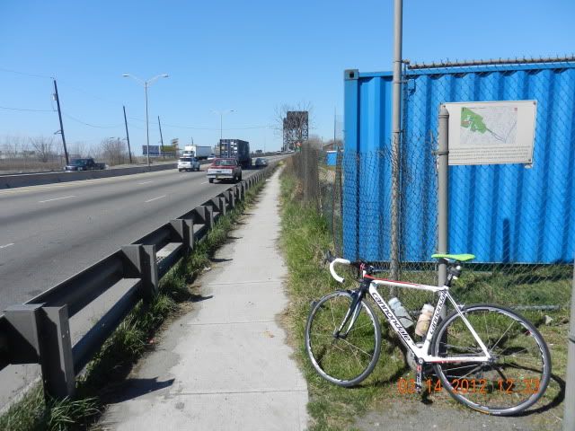
the 2 miles long portion of lincoln HWY from either jersey city or newark side are connected by(US 1- US 9 truck route)
from jersey city it start at lincoln park or on communicapaw ave.
from newark side start at raymond boulevard.
this particular HWY was crucial key for bikers or hikers that travel to and from either both state (NJ/NY) and also serve as LWG (liberty water gap) and ECG (east coast greenway) so..i happened to ride this highway fairly often as my commute route (i'm riding from jersey city to newark then to clifton)
so,..this highway is "little golden gate of the east" or toll for cyclist and hiker.
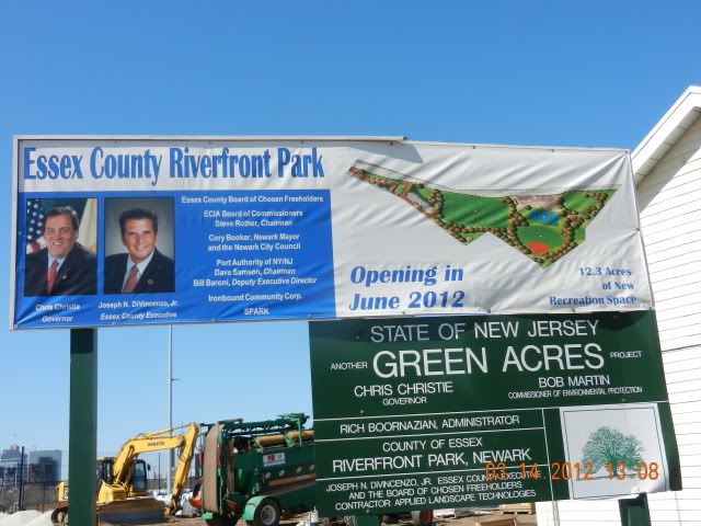
now the good news is...the project for this route (both LWG & ECG) are benefiting indirectly from the newark green acres funds.
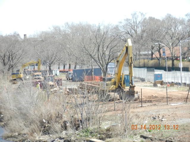
this project was schedulle to be finished on june 2012.i believe they have been working on this since learly 2011.as i notice when i saw last year, that many heavy construction machinery was placed on that river side along raymond blvd.
so my suspection was right,.they were working on some kind of park related project along those river side.this is very exciting to many folks who's commute regularly on that route.
but,..there was some bad news as well.
now,..from raymond blvd towards jersey city.
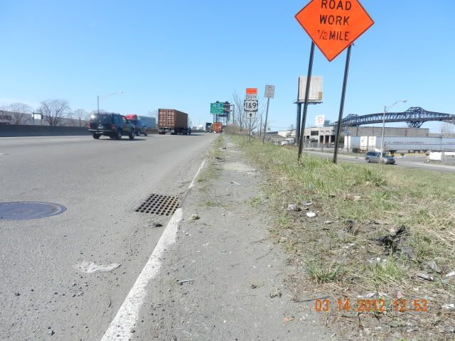
all foot or bike traffic must use lincoln hwy to get to the either side.
coz that's the only fast,short way to get to and from,even a cyclist club in philadelphia annualy pedal on those highway.
how bad is it? you might ask...
for me personaly i don't mind at all.
if you're aren't comfortable riding on busy highway along side 18wheller..then,you'll be just fine.
but,if you're have fear nor trauma or phobia.
then the sidewalk will serve you well...but wait...are you don't mind a little hike-a-bike? after all you'll fear riding along side crazy trucker right?
so,..you got no choice other than walk on the side walk (or ride on side walk)
now,.here's bonus for you.
are you hikers or bikers?
if you're a hikers,please disregards all my comments above.
so,.you're a bikers.
ok,..what bikes did you on? a road bike or MTB?
MTB you say...well,you're lucky!
coz,those rig will work perfectly fine with condition on that hwy or sidewalk.
road bike you say,..then you're out of luck.
coz,those sidewalk are'nt as smooth as baby butt.
(walking is a wise move) but MTB will just plow thru those nasty sidewalk.
coz,.the sidewalk was.
covered with million of debris and garbage you can fine just like in garbage fields.the sidewalk "was" there 5 or ten years ago.
but now it's all covered with debris,mostly in form of sand.
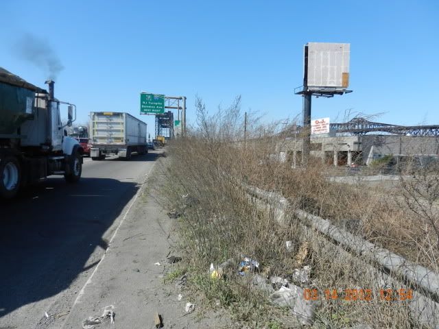
and there was a section that have overgrown tall grassy sticking out to the highway.
it was really not an ideal cycling/hiking route perse..but "a beggar can't choose" right?
so,.is it worth to try? offcouse it is,if you don't mind tho!
it may not ideal,but it will serve your purpose and your accomplisment.
and it's doable,somewhat save (if you pay attention and fully aware of situation) and it's not for 'faint hearted" and absolutely not for "mama's boy"
this route is for all folks who are hardcore and brave heart (trully bikers/hikers)
please,.excuse my english grammar and all.
"me no go to skuull" (say it with asian accent)
http://connect.garmin.com/activity/157937719
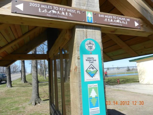
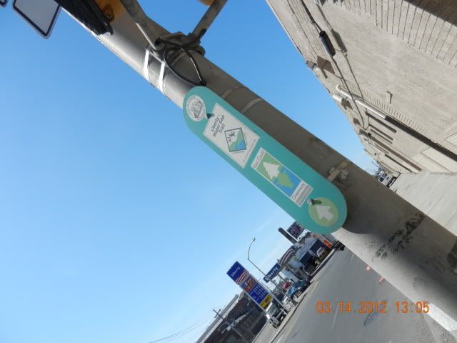
LWG and ECG this signage is located in lincoln park,just off from communicapaw ave.
the white board sign read: the LWG and ECG are end here.all user are advise not to venture any further.because of the route hasn't completed not until june 2012.
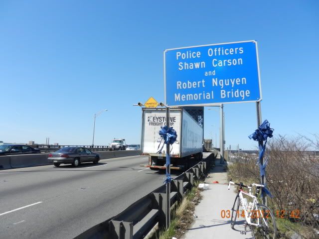
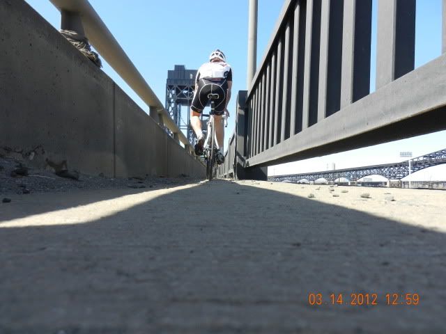
memorial bridge for two police officer that was killed on duty.
(bridge crossing on hackensack river)
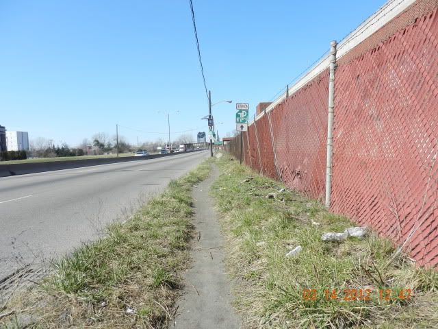
there is actually sidewalk paved here,.but you can't see it.it because covered with thick sand/debris that have accumulated for almost couples season or even more.i walk this sidewalk till the bridge from afar.
sidewalk condition same as above,this one 300yard before bridge.
this one also covered with thick sand.
a few metre before bridge surface.
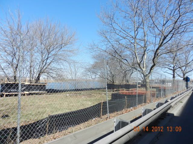
but once,i'ved reach center span of the bridge,it's get cleaner from debris and such.becoz all debris will eventually falls into the river below.
and also,.you may notice the overgrown tall plant or grassy (no have idea what's that thing) it will more difficult to walk when it fully grown in the summer.
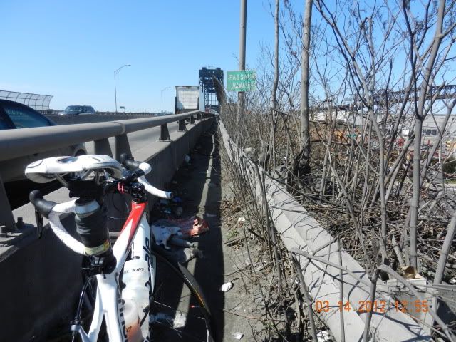
this is the most narrow part of the sidewalk,.it maybe les than 4ft wide.
also with those tall grassy,make it more hard.
from jersey city it start at lincoln park or on communicapaw ave.
from newark side start at raymond boulevard.
this particular HWY was crucial key for bikers or hikers that travel to and from either both state (NJ/NY) and also serve as LWG (liberty water gap) and ECG (east coast greenway) so..i happened to ride this highway fairly often as my commute route (i'm riding from jersey city to newark then to clifton)
so,..this highway is "little golden gate of the east" or toll for cyclist and hiker.
now the good news is...the project for this route (both LWG & ECG) are benefiting indirectly from the newark green acres funds.
this project was schedulle to be finished on june 2012.i believe they have been working on this since learly 2011.as i notice when i saw last year, that many heavy construction machinery was placed on that river side along raymond blvd.
so my suspection was right,.they were working on some kind of park related project along those river side.this is very exciting to many folks who's commute regularly on that route.
but,..there was some bad news as well.
now,..from raymond blvd towards jersey city.
all foot or bike traffic must use lincoln hwy to get to the either side.
coz that's the only fast,short way to get to and from,even a cyclist club in philadelphia annualy pedal on those highway.
how bad is it? you might ask...
for me personaly i don't mind at all.
if you're aren't comfortable riding on busy highway along side 18wheller..then,you'll be just fine.
but,if you're have fear nor trauma or phobia.
then the sidewalk will serve you well...but wait...are you don't mind a little hike-a-bike? after all you'll fear riding along side crazy trucker right?
so,..you got no choice other than walk on the side walk (or ride on side walk)
now,.here's bonus for you.
are you hikers or bikers?
if you're a hikers,please disregards all my comments above.
so,.you're a bikers.
ok,..what bikes did you on? a road bike or MTB?
MTB you say...well,you're lucky!
coz,those rig will work perfectly fine with condition on that hwy or sidewalk.
road bike you say,..then you're out of luck.
coz,those sidewalk are'nt as smooth as baby butt.
(walking is a wise move) but MTB will just plow thru those nasty sidewalk.
coz,.the sidewalk was.
covered with million of debris and garbage you can fine just like in garbage fields.the sidewalk "was" there 5 or ten years ago.
but now it's all covered with debris,mostly in form of sand.
and there was a section that have overgrown tall grassy sticking out to the highway.
it was really not an ideal cycling/hiking route perse..but "a beggar can't choose" right?
so,.is it worth to try? offcouse it is,if you don't mind tho!
it may not ideal,but it will serve your purpose and your accomplisment.
and it's doable,somewhat save (if you pay attention and fully aware of situation) and it's not for 'faint hearted" and absolutely not for "mama's boy"
this route is for all folks who are hardcore and brave heart (trully bikers/hikers)
please,.excuse my english grammar and all.
"me no go to skuull" (say it with asian accent)
http://connect.garmin.com/activity/157937719
LWG and ECG this signage is located in lincoln park,just off from communicapaw ave.
the white board sign read: the LWG and ECG are end here.all user are advise not to venture any further.because of the route hasn't completed not until june 2012.
memorial bridge for two police officer that was killed on duty.
(bridge crossing on hackensack river)
there is actually sidewalk paved here,.but you can't see it.it because covered with thick sand/debris that have accumulated for almost couples season or even more.i walk this sidewalk till the bridge from afar.
sidewalk condition same as above,this one 300yard before bridge.
this one also covered with thick sand.
a few metre before bridge surface.
but once,i'ved reach center span of the bridge,it's get cleaner from debris and such.becoz all debris will eventually falls into the river below.
and also,.you may notice the overgrown tall plant or grassy (no have idea what's that thing) it will more difficult to walk when it fully grown in the summer.
this is the most narrow part of the sidewalk,.it maybe les than 4ft wide.
also with those tall grassy,make it more hard.
Last edited: