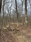
I thought you took care of that with your pack saw?Conditions were great small tree down on grand tourView attachment 233483View attachment 233484


You are using an out of date browser. It may not display this or other websites correctly.
You should upgrade or use an alternative browser.
You should upgrade or use an alternative browser.
Hartshorne/Huber Conditions
- Thread starter jerzey111
- Start date
knobbyhead
Next off the Island.
I had my waist pack. No pack saw on me. Next time maybe.I thought you took care of that with your pack saw?
knobbyhead
Next off the Island.
@EnduroJoe, I'd probably good to go. It rained a lot sat, but it's been windy and the trees are blooming. So I'd say 96% dry. By the alligator it will be wet. endu
I rode Hartshorne last Fri and it was great except for a few spots.
I rode Hartshorne last Fri and it was great except for a few spots.
knobbyhead
Next off the Island.
Huber will be dry. It's always dryer than Hartshorne.Did you ride Huber too?
Rockbottom
Active Member
Do you think conditions here will be fair to ride on Sunday?
Yes.Do you think conditions here will be fair to ride on Sunday?
mwlikesbikes
Well-Known Member
Couple decent sized trees in Huber in the circled area about 50 feet apart

krink
Eddie Munster
Trails were great except the low section of rocky point just north of the river access. A few trees down.Did anyone ride hart this weekend?
How are the trails?
Looking for pointers on where to park to start the loop, is there a map that I can get hold of before hand to map out the loop. I looked at the Wiki section which I thought had maps, etc. but no longer seeing them.
I found this - https://njtrails.org/trail/hartshorne-woods/
Thank You
I found this - https://njtrails.org/trail/hartshorne-woods/
Thank You
krink
Eddie Munster
2 GPX files for Hartshorne and Huber Hartshorne. Some of my preferred ways of riding there. Park at claypit lot.Looking for pointers on where to park to start the loop, is there a map that I can get hold of before hand to map out the loop. I looked at the Wiki section which I thought had maps, etc. but no longer seeing them.
I found this - https://njtrails.org/trail/hartshorne-woods/
Thank You
Attachments
The map can be found here.Looking for pointers on where to park to start the loop, is there a map that I can get hold of before hand to map out the loop. I looked at the Wiki section which I thought had maps, etc. but no longer seeing them.
I found this - https://njtrails.org/trail/hartshorne-woods/
Thank You
Monmouth County Park System Parks Hartshorne Woods Park
This is the loop I like, see map below. If you park at Claypit lot you follow the red line out. This includes a stop at the light house which is not on the map, but the red line will get you there. The blue line is return.
You should use Trailforks app to check out new places. It's easier to follow.