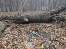
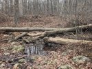
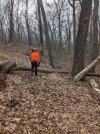
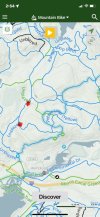
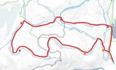
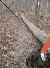
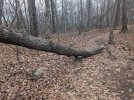
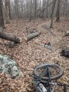
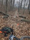
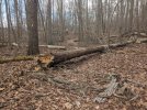
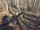
I hit the eastern side of Allamuchy North today, (Thu Jan 4th) starting from the Waterloo Road/Sussex Branch trail lot. 4 hour session, about 5 miles, solo. I cleared all the major stuff I found along my route, and did a handful of tune-ups too. (see attached map. The red waypoints were the original targets). I was on the Pebble loop, hit some of Waterloo/517 trail (White) and finished on the Ranger loop (Red) back to the car. To my knowledge, I’m now all caught up with all reported targets in Allamuchy North! Although I’m sure there’s more. There always is!!
As always, please keep the intel coming, and thanks to everyone who reported stuff. Reminder the best possible intel includes pics and a screenshot of it’s location on trailforks. Or an X on a map. I’m not real familiar with the trail system there, so verbal descriptions often need clarification.
Deer Park probably my next session, followed by Stephens, but no idea when. When the temps drop below freezing, chainsawing not so much fun.


")