


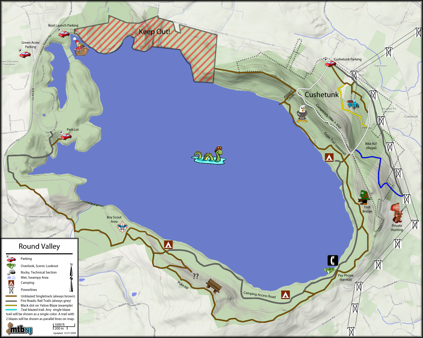
Think this is going to be my mission this year - The white trail
along the ridge, to the point where it connects with red between
round valley road, and the saddle/cross-over to the cushetunk lot.
someone has been cutting out the logs. There are some ribbon markers
and cairns - but the trail is not well defined, and runs through a bramble.
The large log-over along red in that area has been removed/cut - the connection happens just north of there. The trail then dead-ends.
take a look at this track - the picture shows the connection point, the track south uses the first cairn as a starting point, but comes/goes. the track north uses a double track. as an aside, I turned around to hit the downhill from there to the powerlines. FUN!
http://www.strava.com/activities/138239844
(yes, slow motion...save it )
)
geotagged the trees down on this trail last year. gotta find the track.
this would change up the out/back a bit, with minimal work on an existing trail.
whatjathink Woody?
along the ridge, to the point where it connects with red between
round valley road, and the saddle/cross-over to the cushetunk lot.
someone has been cutting out the logs. There are some ribbon markers
and cairns - but the trail is not well defined, and runs through a bramble.
The large log-over along red in that area has been removed/cut - the connection happens just north of there. The trail then dead-ends.
take a look at this track - the picture shows the connection point, the track south uses the first cairn as a starting point, but comes/goes. the track north uses a double track. as an aside, I turned around to hit the downhill from there to the powerlines. FUN!
http://www.strava.com/activities/138239844
(yes, slow motion...save it
)geotagged the trees down on this trail last year. gotta find the track.
this would change up the out/back a bit, with minimal work on an existing trail.
whatjathink Woody?