Mahlon 8am.Rock rill lot.............................


You are using an out of date browser. It may not display this or other websites correctly.
You should upgrade or use an alternative browser.
You should upgrade or use an alternative browser.
Sun 12/9
- Thread starter hardtale70
- Start date
J-Dro
Well-Known Member
I think I'm in. What are we looking at, 2-3 hours of riding?
I know not of this lot you speak of. I know where the Weldon Rd lot is - where's 'dis one?
Mike
It's the southern most lot on Weldon Road. If your heading north on Weldon, look for a dirt road on the right just as you see a welcome to Mahlon sign. If you get to the lot by Saffron Pond, you went too far.
Just a quick 2 hrs as Dave and I are at the shop on Sun..........
Ok 8am rock rill lot.We'll need to keep this ride movin so bring some snappity snap..................see yall in the am.
anrothar
entirely thrilled
i'm at my parent's house right now. i'll post up gps and photos when i get home.
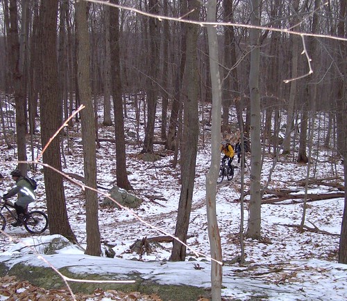
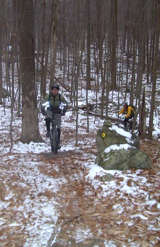
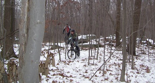
good ride. the trails were it really good shape. maxxis crossmark in fast rolling direction doesn't work in the snow. . seated climbing was mandatory. weirwolves better.
i only ended up doing about 15 more miles. i got hungry, and my parents house happened to be 2 miles away when that happened. so i rolled over, had some food, warmed up by the wood burning stove, decided i liked being warm, got a lift up to my truck....
damnit, left the gps at my parents house...
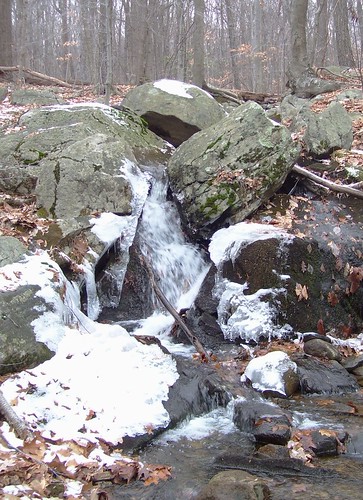
pics:
good ride. the trails were it really good shape. maxxis crossmark in fast rolling direction doesn't work in the snow. . seated climbing was mandatory. weirwolves better.
i only ended up doing about 15 more miles. i got hungry, and my parents house happened to be 2 miles away when that happened. so i rolled over, had some food, warmed up by the wood burning stove, decided i liked being warm, got a lift up to my truck....
damnit, left the gps at my parents house...
pics:
Last edited:
J-Dro
Well-Known Member
Fogerson
Former Resident Nerd
Hi guys...
I'm still learning my way around MD and I see that your route took you west of the railroad bed over into the Weldon Brook WMA a bit. Are those trails marked or are they blazed w/a map existing somewhere? I surfed around a bit and came up with zilch.
Also, the southern part of your ride appears to leave the "yellow" trail and take a path that doesn't appear on the MD trail map. Is that a marked trail and the map hasn't been revised or ??
Yeah, I'm thinkin' that a Garmin Edge 605/705 might be a worthwhile purchase when they start shipping--I could just download the data and let the electronics show me the way. I know, I know, I could just join a ride...but trust me, I'd been dropped or draggin' ya' down before you hit Saffin Pond

Thanks.
Tim
anrothar
entirely thrilled
the wma trails are not marked. the other trail, off the yellow is a technical singletrack that is technically in the wma, and therefor open to bikes. just make sure you turn right at the four way intersection if going down it. otherwise you'll end up on the off-limits highlands trail.
here''s my gps info from yesterdays ride. i turned it on late, at the top of the first climb, so i'm missing a few miles and some elevation. miles 11-15 are road, after that, i hit a couple of the big hills on the buzzards bash route.
http://trail.motionbased.com/trail/activity/4584020
here''s my gps info from yesterdays ride. i turned it on late, at the top of the first climb, so i'm missing a few miles and some elevation. miles 11-15 are road, after that, i hit a couple of the big hills on the buzzards bash route.
http://trail.motionbased.com/trail/activity/4584020