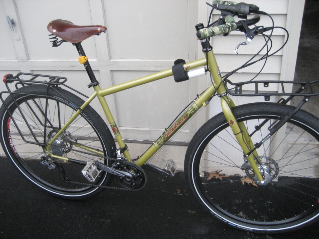
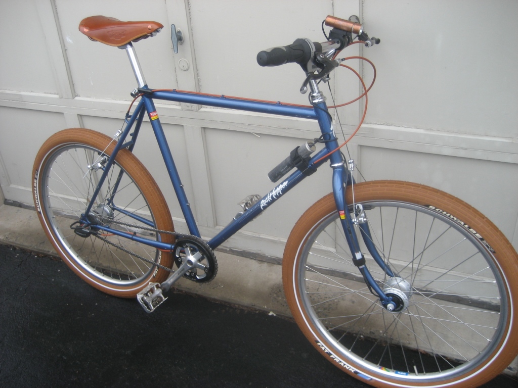
Mutant Century Cue Sheet Available!
We're at T-minus 8 days and counting to the first Mutant Century... High Point to Belle Mead (or other points in Central Jersey)...
Here is the cue sheet. I can also email it to you in Word format... drop me an email at
MontclairBobbyB@gmail.com
We start at 6AM!!! I hope that won't discourage you... just go to bed early... The early start makes the first part of the trip especially awesome... I'm sure you'll agree. If you plan to ride this on your own, GOOD LUCK and enjoy it!!! If you plan to join the mass-mutant start on Saturday morning, June 13 at 6 AM, let me know (via email). We'll need to coordinate ride and shuttle logistics.
Mutant Century 2009 – Cue Sheet
Starting Point: Appalachian Trail head Parking Lot (just South of High Point State Park Visitor Center on Rte 23. Travelling from the South up 23 the lot will be on your left just past the Maintenance Facility and just before the Visitor Center. It’s clearly marked with a sign. The Iris Trailhead is at the rear right corner of the lot, identified by red dot on white trail markers)
Stage 1 – High Point to Waterloo (35 miles)
1. Follow the Iris Trail for 4.5 miles to Deckertown Road. This is double and single track, with a few climbs and stream crossings. Watch for trail splits (most have proper signage; one bears left onto private property – stay right… no big surprises; just keep following in a Southerly direction)
2. Left on Deckertown, which immediately drops down a screaming descent around a curve; watch for first right on File Rd.
3. Follow File Road a short distance, Watch for Nelson Rd on right.
4. Right on Nelson, up a short steep climb, after which it levels out, and follows below a long ridge marking the edge of Stokes State Forest. It eventually becomes Mattison Reservoir Rd... a beautiful 6-7 mile paved cruiser with little or no traffic.
5. Mattison Reservoir Rd ends in a T; turn left (onto Mattison Road), and follow down into Branchville (ANOTHER HIGH SPEED DESCENT… watch the Speed Limit!!!).
6. Mattison ends in Branchville; continue across the main drag (Broad St) to Mill Street.
7. Left on Mill Street; follow a short distance out of town; road splits; bear left on Mill.
8. After short distance, road crosses over a small stream and the Sussex Branch trailhead (unmarked) is off to the right just past the bridge, up a short single track onto a raised trail bed hidden in the trees. That is the start of the Sussex Trail, and you're at roughly the 15 mile mark (from High Point).
9. Sussex Trail continues another 20 miles or so to the Waterloo parking lot (at Allamuchy). Along the way there is break in the trail (approx 1 mile in length, through Newton).
a. The trail dumps you onto Trinity St in Newton. Turn left and a quick right onto Stuart. Stuart turns into Diller and meets Sparta Ave at a traffic light.
b. Turn left on Sparta, and follow approx 1/2 mile to Stickles Pond Road (on right)... Turn right, and Sussex trailhead is straight ahead on the left.
10. The Sussex trail also occasionally may turn to pavement (in Andover and Byram)... just remain on a straight trajectory and you'll eventually rejoin the trail... In Byram at Cranberry Lake, you’ll pass the lake along 206 after which you bear right onto South Shore road... The trailhead is about 1/4 mile up on the left, which will take you straight to the Waterloo Lot.
Stage 2 – Waterloo to Lockwood Gorge/High Bridge (25 miles)
1. From Waterloo lot, turn right down Waterloo Road, and continue under Route 80.
2. Look for the Morris Canal Towpath merging in from the extreme left... it will eventually veer off again to the left (at a 10 o’clock angle) within a half mile or so. Follow this (away from Waterloo Rd).
3. The towpath ends near the concert field (home of JORBAFest). Turn left, and follow road to the end. (This will be Waterloo Valley Road).
4. Right on Waterloo Valley Road. Follow several miles (crossing tracks, past quarry, etc) until it eventually rejoins Waterloo Rd. Just before it rejoins, turn left on a path before the stream (That trail will take you into Stephens Park).
5. Follow the trail a short distance down to the access road at the Visitor Center and map kiosk. Take the jeep trail behind the kiosk (up the hill to the right). This continues to climb (approx ½ mile), where it eventually turns into paved road. Continue to climb the road another half mile or so over the crest of the hill and continue down the hill to a T (Sand Shore Road).
6. Right on Sand Shore, and follow a short distance across Rte 46 (traffic light) after which road becomes Naughright Road.
7. Continue on Naughright for 2 miles to Flocktown Road. You will have 2 options here:
The Untested, but funnerer route:
• Right on Flocktown, follow to Cherry St (2nd left)
• Left on Cherry, follow to dead end, trail should continue into back of Schooley’s Mountain Park (if not, make it work… DO NOT WIMP OUT AND BACKTRACK!!!)
The Sure, but boring route:
• Continue another mile to E Springtown Road
• Right on Springtown, follow to Schooley’s Mountain Park entrance on left
8. Enter Schooley’ Mountain Park main entrance at Springtown Road (lake will be on right). Continue up Grand Loop (lake on right, field on left)
9. Follow trail up gradual hill into the woods, where it loops around to left (at height of land watch for Beeline Trail sign)
10. Take Beeline Trail down mountain (twisty singletrack!), where it ends at Fairview Ave.
11. Cross Fairview and through a grassy field to the left down to Columbia Trail /Patriots Path (rail-trail).
12. Turn right on Columbia Trail. Follow straight through steel yard into sleepy town of Long Valley. Trail disappears for a short stretch, but picks back up across the road.
13. Follow Columbia Trail approx 10 miles down through Califon to Ken Lockwood Gorge (THIS IS A MAGNIFICENT PLACE!!!)
Stage 3 – Lockwood Gorge to Chimney Rock (25 miles)
1. After leaving the gorge (away from stream), trail will pass over Cokesbury Road
2. Leave the trail and take Cokesbury Road East (to the left)… haven’t actually done this yet but it shouldn’t be too difficult to figure out how to get down to the road.
3. Follow Cokesbury Road in an Easterly direction approx 2+ miles into Cokesbury.
4. Bear right onto Califon Road and follow short distance to T.
5. Left on Water Street. Follow 1+ mile into Mountainville.
6. Continue straight through town up Sawmill Road (stream stays on right) approx 2 miles to Old Turnpike. Continue straight across OT for another half mile to a T.
7. Left on Fox Hill, up a short but steep climb to intersection.
8. Right on Hollow Brook Road. After a flat stretch and mild climb, get ready for a white-knuckle, high- speed descent… Hold on for dear life and BE CAREFUL!!!
9. After long descent, road curves and ends at up a short rise at Fairmount Road. Turn right and descend further into Pottersville (past General Store on right).
10. After General Store, continue over grate bridge, bear right, and stay straight (to the right onto McCain Mill Rd) where Fairmount Road turns left.
11. Follow McCain Mill approx 2 miles to Long Road (dirt road on left)
12. Follow Long Road approx 2 miles to Larger Cross (dirt intersection, turn right)
13. Follow Larger Cross approx 2 miles across Lamington Road, then another 1.5 miles to T.
14. Turn left on East River Road (dirt road), and follow short distance to pedestrian bridge crossing the creek on the right.
15. Cross creek and continue up dirt road (Kline’s Mill Road) to Burnt Mills Road.
16. Left on Burnt Mills, follow across 202/206 (road becomes Washington Valley Road)
17. Continue on Washington Valley Road 2.5 miles to Argonne Farm Road on right
18. Follow done Argonne Farm to dead end…. Look for path straight into Middlebrook Trail
19. Left on Middlebrook Trail. Follow approx 3.5 miles (into Washington Valley Park, continuing past Newman’s Lane around left side of Reservoir to path that ends on Chimney Rock Road.)
Stage 4 – Chimney Rock to Home (follow me to my house for another 19 miles; otherwise we part here… nice riding with you, fellow mutant!)
1. Turn right on Chimney Rock Rd, follow down hill across Rte 22 (road turns into Thompson) and across 28 into Bound Brook.
2. After crossing 28, turn left on Longwood.
3. Follow to end, right on Vosseller.
4. Left on W Franklin. Follow to end.
5. Right on John, follow down to Main Street.
6. Left on Main, follow to circle and take RR underpass to right.
7. Cross over river and take D&R Canal Towpath on far side of bridge
8. Follow towpath approx 12 miles to Griggstown Crossing
9. At Griggstown, turn right, leaving towpath and continue to T (across 1-lane bridge)
10. Left on River Road. Short distance to Belle Mead-Griggstown Road.
11. Right on BMG Road. Follow 1 mile to Harlingen Road on left
12. Left on Harlingen
13. At T, continue across street into park on paved trail. Bear right and follow through park, across 2 bridges into playground area… Continue up left side of park past playground and basketball court.
14. At end of park (at road), turn left and follow sidewalk into neighborhood, PAST club house.
15. AFTER club house turn left on Matthews Farm Road.
16. Fourth house on left, #94 – Congratulations, you’ve completed the Mutant Century!!!!!


