Freerider72
New Member
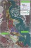
MRBNP is a small preserve just south of Millville with about 6-8+ miles of mostly single track loops with sections ranging from easy to advanced with some features sprinkled around if you know where to look. These are multi-use trails so watch out for hikers, bird watchers, family picnics, ect. Really nice, little known, growing trail system with lots of potential. (Think mini Ceres, Jorba needs get a hold of this place, it could use some help and riders). Trail head parking at MRBNP sign on Silver Run rd. about 1 mile north of Laurel Lake.
Last edited:
") I googled it and only found a preservation site which led me to believe it's hiking only, so I think I must have missed something here.
I googled it and only found a preservation site which led me to believe it's hiking only, so I think I must have missed something here.