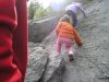
We take our kids over to hike at Ralph Stover (High Points). It's got some good rocky climbs. It isn't huge (but it's at least 3 miles) and you definitely won't get lost. It is beautiful though. You can hike down to the river and often see kayakers going by. There are places you can watch people repelling (spelling?). It is right over the border into PA from either Frenchtown or Stockton. Here's a pic from last week.
For a challenging hike "Breakneck Ridge" is awesome and this is the prefect time of year for it. It is just north of the Bear Mt bridge in NY but worth the drive, beautiful we were there this week.
This is from a NY hiking site:
Total Distance: approximately (3.1, 3.2 or) 5.5 miles
Difficulty: medium - difficult (multiple rock scrambles)
Estimated hiking time: 4+ hours - 2 people, 5 - 6.25 hours - group
Hiking Notes
The hike begins on west side of the road where you will find the Breakneck Ridge Trail (white blazes). This first section of the hike involves 1.5 miles of sometimes difficult climbing and rock scrambling until you reach a 1200 foot crest.
After reaching the crest a red blazed trail (Breakneck By-Pass trail) will intersect from the left, continue straight. A blue blazed trail (the Notch trail) will merge with the white blazed trail we are on. Follow the white (and blue blazed) trail.
Make a left onto an unmarked fire road and a half a mile later make another left onto the Wilkinson Memorial trail (yellow blazes) (the turn onto the Wilkinson Memorial Trail is poorly marked!). In about 1.5 miles you will reach two nice views from atop Sugarloaf Mountain (eat a well deserved lunch here - at the first viewpoint). Continue on this trail until it takes you back to the road and your car.
Alternative (Easier) Route #1 (3.1 miles, under 4 hours): From the Breakneck Ridge Trail (see above), make a left onto the Breakneck Bypass trail (red blazes). At the end of the Breakneck Bypass trail make a left onto the Wilkinson Memorial trail (yellow blazes). Take this trail back to Route 9D and your car (probably a left turn once you get to Route 9D).
Alternative (Easier) Route #2 (3.2 miles, under 4 hours): From the Breakneck Ridge Trail (see above), make a right onto the Notch Trail (blue blazes). Eat lunch at the nameless lake on the left or at the abandoned mill soon afterwards. Where the Notch Trail intersects the Brook Trail (red blazes) take the Brook Trail until the road. Make a right turn on the road and take the road back to your car, just beyond the underpass.
REFERENCES: NY-NJTC Map #102 (East Hudson Trails)
http://www.nycdayhiking.com/breaknec.htm
We've use this trail to train for the Iron Cross race where there is a big climb. Steep but fun and great views!