Chimney Rock Conditions

1000005760-01.jpeg


Meanwhile, on the same ridge 16 miles east the trail is packed rite.
 
Hope it’s found. Always use the little leash they give you. I lost one in the snow at allaire about 5-6 years ago. I was lucky to find it after backtracking my route through.
I’ve used the leash ever since
Yeah lesson learned. I picked it up when I first started MTB in late 2019, probably just threw the leash out and never gave it another thought. Also unlucky that it wasn’t findable via the app because my kid had recently deleted the app from my phone (and therefore unpaired it).

I went out today to try and find it, conditions were surprisingly good (but slippery in some spots). But it’s warming up towards end of the week…
 
Hey guys, went out in the snow today and lost a Garmin Edge 1030, most likely on Red. I don’t have much hope of finding it, but if you see it anywhere or if someone put it by the parking lot, please let me know!
There's hope. I recently (January) found someone's lost Edge 530 on Black Magic at Mahlon Dickerson. The owner lost it in November, and it survived being ridden over (was wedged in the dirt on the line), rain, and quite frigid temps. I was able to locate the owner and return it to him a few weeks ago.
 
There's hope. I recently (January) found someone's lost Edge 530 on Black Magic at Mahlon Dickerson. The owner lost it in November, and it survived being ridden over (was wedged in the dirt on the line), rain, and quite frigid temps. I was able to locate the owner and return it to him a few weeks ago.
Wow that’s awesome! Thanks for the ray of hope :)
 
IMG_7868.jpeg


Taken yesterday morning on Red. The higher you go, the more snow/hard pack. Closer to the reservoir it melted and refroze, had to walk the bike it was so slippery. Only muddy in a few spots with lots of sun exposure. But that was yesterday morning…
 
It's wild how different things look in my yard that's 2 miles away from the red trail! Basically no snow "down" here near 22.
 
I just did a quick scout of all the trail heads off of the Miller Lane lot and Gilbride lots. Going to head back with my bike around noon and will give an updated report.

From Miller everything I I looked at on yellow and green seems like it's okay to ride. On Gilbride, the bottom of Yellow looks good too. there's a couple of soggy sections on the orange switchbacks going up, but it seems promising, though not as confident as Yellow. The trails along the river towards Vosseller need more time.
 
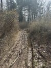
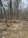
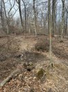
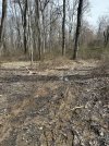
As of 12:30pm. Trails are very dry in most areas until you get to the 1 mud pit that will just ruin your momentum. You make the decision for yourself I road some top yellow next to Miller lane then top of red which was the best after I road Newman climb on blue to the interior downhill I posted the areas of mud that I came upon
 

Attachments

  • IMG_3408.jpeg
    IMG_3408.jpeg
    225.1 KB · Views: 73
  • IMG_3416.jpeg
    IMG_3416.jpeg
    235.9 KB · Views: 72
  • IMG_3417.jpeg
    IMG_3417.jpeg
    234.8 KB · Views: 70
  • IMG_3418.jpeg
    IMG_3418.jpeg
    223.5 KB · Views: 72
  • IMG_3420.jpeg
    IMG_3420.jpeg
    232.5 KB · Views: 80

Trail Conditions

Current Conditions

powered by Trailforks.com
Back
Top Bottom